Defining location information using the Plot field
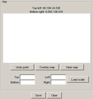
The Plot field on the right side of the SimPSY Route dialog includes an area, which is used for drawing the route, fields for entering the corner coordinates of the area, and buttons for route-related functions.
The current coordinates are displayed above the drawing area. To change the coordinates, enter new coordinates, either using the “N”, “S” notation or by using negative and positive values in the fields, and click Load scale. The new coordinates are displayed above the drawing area. Note that loading a new scale deletes all existing coordinates in the route, as scaling them might easily cause confusion.
The Undo point button undoes the last coordinate and is unlimited, that is, you can undo settings all the way to the first coordinate. The Clear button clears all existing coordinates from the route.
To get a more realistic view of the route, you can overlay an image
on the drawing. To overlay an image, click the Overlay map button and
then select the image to overlay. The supported file formats are JPEG, PNG and GIF.
It will work even though the image is not of the right size (the size of the
window is typically 377x200 pixels.) Overlaying the image does not affect
the output of the plug-in.
